.png)
Zhijiayang Mountain and Snow Mountain South Peak 台灣志佳陽山和雪山南峰
- The Cartographer

- May 12, 2021
- 10 min read
Updated: Apr 27, 2024

INDEX
Overview / The approach (and optional base camp) / The ascent and the peak / Onward towards Snow Mountain /Snow Mountain South Peak, water source, and campsite / The return / The nitty-gritty (GPS, GPX, and more)
Zhijiayang Mountain and Snow Mountain South Peak
台灣志佳陽山和雪山南峰
OVERVIEW
Taiwan's Zhijiayang Mountan (志佳陽山) is one of the famous Top Hundred Peaks of Taiwan (台灣百岳). More than that, it's the original, Japanese era hiking trail to Snow Mountain (雪山)! This post tells how to get there, how to get in, and how to get all the way to Snow Mountain South Peak (雪山南峰).
*Please note that The Map Room participates in the Amazon Associate Program, and other affiliate programs, and may earn from qualifying purchases at no extra cost to you.

Amazing view of Zhongyang Jian Mountain (中央尖山), Snow Mountain (雪山), the Ridge of Death (死亡稜線), and the Holy Ridge (聖稜線) on the old, Japanese era route to Snow Mountain from Zhijiayang Mountain (志佳陽) in Taiwan

The sunset lights up Taiwan's Zhongyang Jian Mountain in hues of red and pink and orange

Zhongyang Jian Mountain at sunset

The view from the top of Zhijiayang

Water source just past the Xueshan (Syueshan / 雪山) Campground, where a cabin once stood. This photo was taken during a historic drought, so water should be available most times.

THE APPROACH AND OPTIONAL BASE CAMP

To get to Taiwan's Zhijiayang Mountan, and beyond it to Snow Mountain South Peak (and Snow Mountain Main Peak), you need to first pass through Huanshan Tribal Village (Sqoyaw / 環山部落). It is beautiful and vibrant, and the locals are incredibly kind and welcoming! You can take mass transit to and from the local 7-11 (see below).


Follow the road down to the valley.


Cross the suspension bridge


Look for this bridge. Go under it, then up to the left, and cross it. There is also an alternate route through some farmland, instead of by the riverbed. You'll pass through a gate into farmland and eventually take a right to cross that bridge. There are signs along the way, but it's still not super clear. Either will get you to the same place!


Follow the signs


Once we passed this metal walkway running alongside the river, we came to the campground where we stayed the night (below). We had originally planned to go up Zhijiayang Mountain in the evening and sleep at the Piaodan Pool Shelter (瓢簞山屋), but we had time to spare so we decided to take it easy and camp at the foot of the mountain for the night instead.

Another small campsite before where we camped


Camping just below the long, uphill section towards Piaodan Pond Cabin


THE ASCENT AND THE PEAK

The next morning, after sleeping in a bit, we were rewarded with great weather, beautiful flowers, and amazing views all the way up to the peak of Zhijiayang!

There is a lot of uphill to negotiate, and in wet conditions I think it would be a lot less fun, but the weather was perfect during our hike.


Beautiful flowers on the hike up Taiwan's Zhijiayang Mountain


At the top of the main slope things level off a bit before Piaodan Pond Cabin. There is another trail splitting off from here towards Mawuba Mountain - one much less traveled and more challenging - heading down in a different direction. We weren't there for that though, so we just passed on by.

Arrow bamboo crowds the side trail to Mawuba Mountain in Xueba National Park, Taiwan


Getting close to the peak!


A small campsite / rest area part way up the climb to Zhijiayang

Piaodan Pond Cabin, 'pond,' and campground. There was no water when we passed by.

Piaodan Pond Cabin on Taiwan's Zhijiayang hiking trail

Hiking in Taiwan, you usually have much better cabins than Zhijiayang Mountain's Piaodan Pond Cabin...

...but it will keep you dry and warmer than if you were outside!

"If you come here on a day with good views, take five extra minutes to go past the peak of Zhijiayang Mountain through the bamboo and get a look at Snow Mountain. You won't regret it, and you'll really be missing out if you don't!"

Looking back, there was a great view of Piaodan Pond Cabin (瓢簞山屋, the little white rectangle) with Zhongyang Jian Mountain (中央尖山, the massive, spiky point dominating the left of the horizon), The Nameless Mountain (Wuming Mountain, 無名山), and the Ridge of Death (Death Ridge, 死亡稜線). Having hiked all of these, it was amazing to look back at them from such a relatively easy hike and just enjoy relaxing in perfect weather on a sunny day!

The view north along Taiwan's Snow Mountain range from Zhijiayang Mountain

We sort of stumbled upon the 'peak' of Zhijiayang without completely realizing it at first. While there is a lot of uphill, we had been taking it easy and enjoying the amazing weather and beautiful scenery so much that it surprised us once we got there!
ONWARD TOWARDS SNOW MOUNTAIN!

While we hadn't originally planned on going any further, the day was still young and Snow Mountain South Peak was - we thought - just up ahead, so we decided to keep going!

There is a short stretch of arrow bamboo on the trail towards Snow Mountain and the Holy RIdge just past the second of the two peaks of Zhijiayang, but it doesn't take much time or energy to get past it. Once you do, you're treated to an AMAZING view of Snow Mountain from a different direction than most people get to see. If you come here on a day with good views, take five extra minutes to go past the second peak of Zhijiayang Mountain through the bamboo and get a look at Snow Mountain. You won't regret it, and you'll really be missing out if you don't!


Snow Mountain Main Peak loomed in the background as we approached the peak of Zhijiayang Mountain.

Views of Snow Mountain from just beyond the peak of Zhijiayang Mountain


Rocky ridge just beyond the peak of Zhijiayang Mountain

Looking back over fields of dwarf bamboo, we were treated to still more stunning views of Zhongyang Jian Mountain!

Looking back at the view of Zhijiayang Mountain in Taiwan


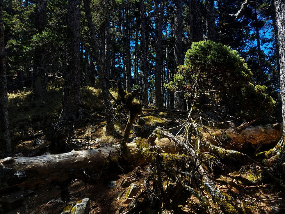
Once we passed the dwarf bamboo, we came to a steep, and beautiful, mountainside forest.


Dead trees in the forest south of Taiwan's Snow Mountain South Peak


Looks like somebody needs to learn how to choose better hiking shoes!

Our first close-up view of Snow Mountain!


SNOW MOUNTAIN SOUTH PEAK,
WATER SOURCE, AND CAMPSITE

After a while, we came to the former site of the Syueshan (Xueshan, 雪山) cabin. While there is no remaining trace of the cabin itself, it is a wonderful, flat campsite with a seemingly very reliable water source nearby. Even in the drought we were able to get plenty of water - though we needed to filter and treat it.

Once you reach the Syueshan (Xueshan, 雪山) cabin site campsite, look for a path going straight up the hill. This will take you to Snow Mountain South Peak. The other path - downhill in the direction of Snow Mountain Main Peak - passes the water source and then takes you exactly there. Apparently it's a very, very steep uphill, but we didn't have time for that on this particular hike.


The Syueshan (Xueshan, 雪山) cabin site water source (above, in drought conditions) and the path leading there (below).

The water source in drought

The path to the water source

Another view of the Syueshan (Xueshan, 雪山) cabin area campsite

The views of Snow Mountain from Snow Mountain South Peak are absolutely spectacular! Even with the great weather and views we had had so far, this was one of the biggest highlights of the whole day!


The marker on top of Snow Mountain South Peak


Looking back past Zhijiayang Mountain towards the Ridge of Death from Snow Mountain South Peak


Zhijiayang as viewed from Snow Mountain South Peak

THE RETURN

Finally, it was time to head back. We had a long way to go still go get back to Huanshan!

Flowers above Zhijiayang Mountain


Zhongyang Jian Mountain loomed in the distance as the sun began to set...


Sea of clouds

By the time we got down, it was well and truly night time. It had been an amazing hike, and we had seen so much! We returned to Huanshan to spend the night (DEFINITELY arrange this in advance if you're getting down later - we were EXTREMELY lucky to find a place to stay!). The next day it was back to the 7-11 to wait for our bus back home.
THE NITTY-GRITTY
Skill level:
High intermediate (Zhijiayang - IF you're acclimatized for breathing at higher altitudes) - low advanced (Snow Mountain South Peak)
Length of hike (Trailhead - Zhijiayang Mountain):
About 10 km one way
Length of hike (Zhijiayang Mountain - Snow Mountain South Peak):
About 3.5 km one way
Time:
Trailhead - Zhijiayang Mountain:
MY time: 5:45
MAP time (see remarks): 9:40.
Time:
Zhijiayang Mountain - Snow Mountain South Peak:
MY time: About 3 hours, including time for lots of pictures.
MAP time: 4 hours
Important note:
Zhijiayang has two so-called peaks. There is really only one peak, but somehow the mapping point (where everyone takes their pictures) is a short distance below the real peak. Make sure not to stop at one without getting to the other!
IMPORTANT:
I am very fast. For Zhijiayang, one good possibility is leaving early in the morning, dedicating the day for it, coming back in the evening, and having a head lamp just in case. For Snow South, spend the night, for example at the former site of the Syueshan (Xueshan, 雪山) cabin, just below the peak. You can get to Snow Mountain Main Peak from here as well!
Water sources:
You can get water from the creek on the way, in, but it should be filtered, and possibly boiled or treated, due to the high volume of hiking traffic in the area. There is also farming, so you might consider just bringing your own.

The Map Room personally uses and highly recommends the Sawyer Squeeze water filter (NOT the Sawyer Squeeze Mini - Amazon affiliate link*)
There is sometimes a pond at the Piaodan cabin (瓢簞山屋) and campsite, but it was completely dry when we passed by.
There is a water source just past the former site of the Syueshan (Xueshan, 雪山) cabin. It had water even during a historic drought in spring of 2021.
NEVER drink water from slow moving or still sources without treating it first, as fast moving water is cleaner and kills various nasty little creatures that could otherwise make you sick.
Gear and provisions:
Good hiking shoes, hiking-appropriate clothes (see remarks), a lighter (always!), a headlamp or flashlight. For the day hike: lunch and snacks, possibly dinner. For overnighting, be ready, well, to spend the night. Hiking poles recommended.

The Map Room recommends Fenix headlamps for high-quality, durable headlamps for hiking and river tracing (Amazon affiliate link*).
Sun protection:
Yes for the Zhijiayang area.
Yes for teenagers 13 or older in good physical condition (this will likely be strenuous for them). Adults in less than good physical condition will find this hike strenuous as well.
Dog friendly:
Not unless your dogs are already used to serious uphill in high elevations for extended periods of time, in which case they might get to Zhijiayang with you lifting them over some rope and scramble sections. Use your best judgement.
Camping /overnighting options:
There are several overnight options. The most useful are:
The large campsite right at the base of the Zhijiayang ascent.
Piaodan Pond Cabin (瓢簞山屋, be aware of the condition this 'cabin' is in!).
There is also the small campsite on the way in, well before you reach the large campsite, as well as other campable places on the way up Zhijiayang (see below).
Registration information:
You will need to register for the hike at this link.
GPS links:
Day hike (1 of 2):
GPX download 1 of 3: Zhijiayang 1 Trailhead to Campsite - The Map Room 營地-志佳陽,地圖寶庫
Day hike (2 of 2):
GPX download 2 of 3: Zhijiayang 2 Campsite to Zhijiayang - The Map Room 登山口-營地, 地圖寶庫
Optional overnight extension:
GPX download 3 of 3: Zhijiayang 3 Zhijiayang to Snow Mountain South Peak - The Map Room 志佳陽-雪山南峰,地圖寶庫
Further Remarks:
"Map time:"
This is the time as indicated on Taiwanese hiking maps (widely available at outdoor stores across Taiwan).
Clothes:
Regardless of the hike, it ALWAYS pays off to have appropriate hiking clothes! These should be clothes you don't mind getting dirty and/or messed up. Pants, shirts, socks, and underwear should all be quick wicking to get sweat off of your skin and quick drying to get it off of your clothes. For these reasons, you should NEVER wear cotton hiking! Sports pants and a sports shirt are a good place to start, but hiking pants have many advantages. A bandanna, headband, or other light cloth for wiping sweat is also advisable.
Water:
For this hike, I personally drink 2 liters per day in winter, 2-3 in summer, but I drink a lot of water and you may drink less than me. It's better to have extra than too little, though.

The 7-11 at Huanshan Tribal Village (Sqoyaw / 環山部落). This is where busses start and stop, and makes a great place to get supplies, or rest up after a long hike!


Bus schedule for the 7-11 at Huanshan Tribal Village (Sqoyaw / 環山部落)


So now you're ready to go! Get out there, enjoy nature, learn to hike, and have an amazing time!
All information on this page is intended for reference only. Preparing adequate food, water, and gear for your adventure, as well as following local rules and laws are, of course, your own responsibility! Always make sure that you check the weather for outdoor destinations, be careful and sensible for enclosed spaces like tunnels and bunkers, and bring a lighter - you never know when it could save your life! Now... get out there and have an amazing time!

10% discount on Parkbus Taiwan! Click the link and enter the discount code MapRoom10 for a 10% discount on Parkbus Taiwan rides!
The Map Room has an affiliate arrangement with Parkbus Taiwan and will receive a commission if you do. We stand strongly by our affiliates, because at the end of the day, they help get us safely to the end of the day.

Click the link above to get 20% off a year-long, premium Gaia GPS subscription! The Map Room has an affiliate arrangement with Gaia and will receive a commission if you do... but we ONLY recommend products that we have tested, used, and loved in the field ourselves! We stand strongly by our affiliates because, at the end of the day, they help get us safely to the end of the day.

Hi! You love the outdoors and so do we! Please help support The Map Room so we can keep helping you do what we love to do!
*Please note that The Map Room participates in the Amazon Associate Program, and other affiliate programs. Some of the links on The Map Room may refer to Amazon or our other affiliates, and as a member of these, The Map Room will receive a commission at no additional cost to you. We ONLY endorse products we ourselves use, have used, or would use personally!


Comments